Venue
Port of Saint-Malo
Saint-Malo, France
No sailing events scheduled at Port of Saint-Malo.


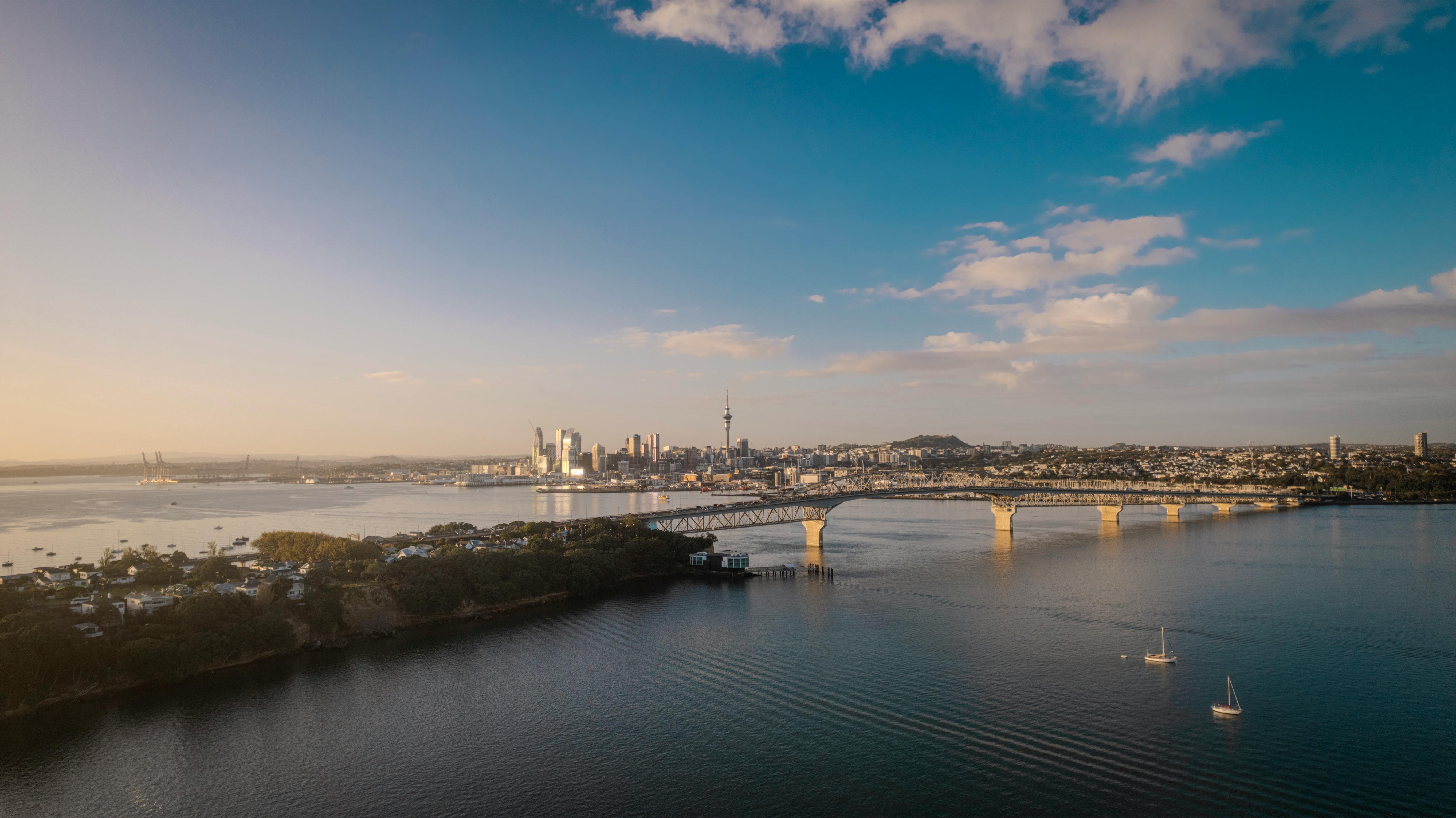
The Port of Saint-Malo, a fortified medieval city on the Brittany coast of northwestern France, is the start of the Route du Rhum transatlantic race held every 4 years and one of offshore sailing's most storied departure points, drawing up to 500,000 spectators for race starts. The granite walls rise straight from the sea, dark and weathered, built to withstand both English cannonballs and Atlantic storms. Behind them, the cobbled streets of the old town smell of crepes, salt, and centuries of maritime defiance.
The port sits on a promontory jutting into the English Channel, exposed to the full force of the Atlantic weather systems that roll in from the west. But the defining feature of Saint-Malo is not the wind. It is the tide. The tidal range here reaches 14 metres during spring tides, one of the largest in the world and matched globally only by the Bay of Fundy in Canada and a handful of other extreme locations. At low water, the harbour floor is exposed mud. At high water, boats float alongside ramparts that were dry ground six hours earlier. The tidal currents between the offshore islands, the Iles Chausey and the Iles Anglo-Normandes, reach 5 to 6 knots, fast enough to stop a sailing boat dead or sweep it sideways into granite.
The Route du Rhum's famous 13:02 start is timed to coincide with favorable tidal conditions for the fleet's passage out of the Channel. Get the tide wrong here and the race is over before the Atlantic begins. The English Channel itself is one of the world's busiest shipping lanes, requiring departing race boats to navigate through commercial traffic while managing the powerful tidal streams.
Water temperature in November is 13-15 degrees Celsius: cold, in the English Channel, the way the English Channel is always cold. The Brittany coast in autumn brings the full Atlantic weather repertoire: depressions tracking northeast from the Azores, northwest swells generated by North Atlantic gales, and the sharp clarity of cold front air that makes the granite coast look its most dramatic.
The Route du Rhum was first held in 1978 and has run every four years since. The course from Saint-Malo to Pointe-a-Pitre in Guadeloupe covers approximately 3,542 nautical miles of the North Atlantic, with the fleet encountering the full range of conditions from North Atlantic gales to the trade winds of the tropics. The race was created as a solo transatlantic in a spirit of extreme individuality: one boat, one sailor, 3,500 miles.
Saint-Malo produced the corsairs, the privateers who were authorized by the French crown to prey on foreign shipping. The city's identity is built on maritime courage and independence. The same harbour that launched Jacques Cartier to explore Canada in 1534 now launches ULTIME trimarans with 35-metre wingmasts toward the Caribbean. The historical continuity is not just atmosphere: it shapes how the city receives and celebrates offshore sailing.
The race village that occupies Saint-Malo's basin for two weeks before the start draws over a million visitors, making it the largest free maritime event in France. You can walk among ULTIME trimarans and IMOCA 60s, close enough to touch hulls that in a week will be surfing North Atlantic swells at 40 knots with a single human aboard. The boats are moored alongside the ramparts, dwarfed by the medieval walls. Children press their faces against carbon fiber. Old sailors shake their heads at the size of the foils. The contrast between the ancient stone and the bleeding-edge technology is Saint-Malo's gift to the sport.
The ramparts themselves are the best spectator platform for the start. Thousands line the walls as the fleet crosses the start line below. Within hours, the boats are alone on the Atlantic.
Saint-Malo occupies a tidal island at the mouth of the Rance River, connected to the mainland by causeways since the 19th century. The surrounding waters, the Rance estuary to the south and the Iles Chausey archipelago to the northwest, create a complex tidal geography that produces the extreme ranges for which this coastline is known. The Rance tidal barrage, one of the first commercial tidal power stations in the world, was built across the estuary in the 1960s, harnessing the same tidal energy that challenges departing race boats.
The IANA timezone is Europe/Paris (CET, UTC+1 in November when the Route du Rhum starts). A 13:02 CET start converts to 12:02 GMT in London, 07:02 EST in New York, and 23:02 AEDT in Sydney.
Then November 1 arrives, the cannon fires, and the fleet sails out through the granite channel toward the open ocean. The ramparts fill with people watching the sails shrink toward the horizon. Within hours, the boats are alone.